Safe Streets Construction Highlights 2021
- clara
- Dec. 15, 2021

North Seattle: New sidewalks and Connections to new light rail stations!
Three new light rail stations opened this fall, and along with them several important new routes that will help people access the stations and make our transit system more accessible to more people. The biggest and most anticipated is the new John Lewis Memorial Pedestrian bridge, allowing access across I-5 to the Northgate Link Light Rail Station. New bike lanes now connect around the east side of Green Lake (pictured above). Green Lake Wallingford Safe Streets advocacy heavily influenced the accompanying pedestrian improvements that square up intersections and improve access to the park. This project, which connects to the new Roosevelt Light Rail Station via protected lanes on NE 65th St and NE Ravenna Blvd, was originally also meant to include bike routes on Stone Way and N 40th St, but those segments were cancelled (for now). Other improvements include new sidewalks on NE 43rd St accessing the University District station, and the new Northgate Neighborhood Greenway, including intersection improvements at 8th Ave NE and Northgate Way. Lake City Way Safety: This year also saw the completion of new sidewalks, crossings, and intersection improvements along Lake City Way, dramatically improving pedestrian access and safety on what has historically been one of Seattle's most dangerous corridors. Connections South to Downtown: N 34th St now has new parking protected bike lanes (pictured above), including many design suggestions from Ballard-Fremont Greenways. This route improves access to the Fremont Bridge and connections south to the Westlake Trail and downtown, and makes it possible for people of all ages and abilities to ride from Gasworks Park to Pike Place Market, downtown, or Chinatown/International District.

Central Seattle: Downtown Basic Bike Network
After many years of delays and continued pressure and advocacy, we finally have a new 2-way protected bike lane on 4th Ave through downtown Seattle (pictured above)! With the new short segments of bike lanes in Uptown around the new Climate Pledge Arena and improvements on Alaskan Way, downtown Seattle has never been easier to get around by bike. South Lake Union: Short segments of new bike lanes on Eastlake Ave through South Lake Union and the newly re-opened Fairview Ave bridge set the stage for the future protected bike route which will connect from Lake Union Park along Eastlake Ave to the U District Station as a part of the Rapid Ride J line (construction to begin in 2023).
Central District: New protected bike lanes on E Union St include protection around the intersection with 23rd Ave, which Central Seattle Greenways (CSG) advocated heavily to include after it was not included in the original design. CSG celebrated with a group ride.
South Lake Union: Short segments of new bike lanes on Eastlake Ave through South Lake Union and the newly re-opened Fairview Ave bridge set the stage for the future protected bike route which will connect from Lake Union Park along Eastlake Ave to the U District Station as a part of the Rapid Ride J line (construction to begin in 2023).
Central District: New protected bike lanes on E Union St include protection around the intersection with 23rd Ave, which Central Seattle Greenways (CSG) advocated heavily to include after it was not included in the original design. CSG celebrated with a group ride.
 Connections South: New protected bike lanes on 12th Ave S (pictured above) now connect people safely from the King St neighborhood greenway in Little Saigon over the Jose Rizal bridge to the I-90 Trail at the north end of Beacon Hill! Even more exciting, after many years of advocacy by Beacon Hill Safe Streets, the dangerous slip lane at the top of the bridge has been closed. Though short, this 4 block connection is the first direct bike route designed for people of all ages and abilities that connects from downtown to the entire southern half of Seattle. It also sets the stage for the future bike connection currently being planned along the spine of Beacon Hill (construction to begin in 2023).

West Seattle: Rapid Ride and Greenway Improvements
2021 brought the completion of the West Seattle Neighborhood Greenway, which connects all the way from Alaska Junction to High Point, Fairmount Park, and down to Roxhill Elementary School. After many years of advocacy from West Seattle Bike Connections, the new Rapid Ride H line (formerly Delridge Rapid Ride) multimodal improvements included sections of protected bike lanes as well as neighborhood greenway improvements and pedestrian improvements, including a traffic signal and diverter at 35th Ave SW and SW Graham St. And most noteably, the Duwamish Longhouse on West Marginal Way SW has a new sidewalk, traffic light and crosswalk (pictured above) connecting the longhouse to bus stops, the Duwamish Trail, and car parking across the street. This comes after many years of advocacy from the Duwamish Tribe and allies, including West Seattle Bike Connections and Seattle Neighborhood Greenways.
South Seattle: Safe Streets Infrastructure Investments Still Lagging Behind the Rest of the City
South Seattle has historically received significantly less safe infrastructure investment than the rest of the city, and despite many promises to prioritize equity from SDOT and our elected leaders, this underinvestment continues. The lack of safe streets has tragic consequences for south end families and communities -- of the 31 people who have been killed in traffic collisions this year alone, 18 were killed in District 2, which includes Rainier Valley, Beacon Hill, SODO, and parts of Chinatown/International District. This is not acceptable, and we must do more to prioritize safe streets for SE Seattle. The only bike infrastructure installed in SE Seattle this year was a refresh of the S Kenyon St Neighborhood Greenway (pictured above), providing a valuable East-West connection from Beacon Ave S to Seward Park Ave S, improving crossings of dangerous arterials and connecting to the Chief Sealth Trail and Rainier Valley neighborhood greenway. Pedestrian Improvements: There were many exciting pedestrian improvements in South Seattle, including:- The intersection of 15th Ave S and S Columbian Way is finally improved after years of advocacy from Beacon Hill Safe Streets. These changes dramatically increases safety and access for students at Mercer International Middle School as well as people accessing Jefferson Park, the business district, and the VA Hospital.
- Rainier Ave S received hardened centerlines at four intersections, with potentially more to come! Although they may seem insignificant, these small plastic strips force drivers to slow down when turning, and make walking or rolling across the street feel considerably safer. Rainier Valley Greenways-Safe Streets continues to advocate to improve safety and reduce speeding on Rainier Ave S.
- I-90 onramps on Rainier Ave narrowed from two lanes of vehicle traffic down to one. After continued pressure from Rainier Valley Greenways-Safe Streets and Disability Rights Washington, people crossing here or accessing the Judkins Park station are now significantly more visible to drivers and have a much shorter distance to cross.

Citywide Improvements: Lowered Speed Limits and Safe Routes to Schools
- SDOT installed signage lowering speed limits to 25 mph on most major streets -- a total of 415 miles of Seattle's arterial streets are now 25 mph! Lower speeds decrease the number of collisions that occur as well as the severity and likelihood of serious injury or death.
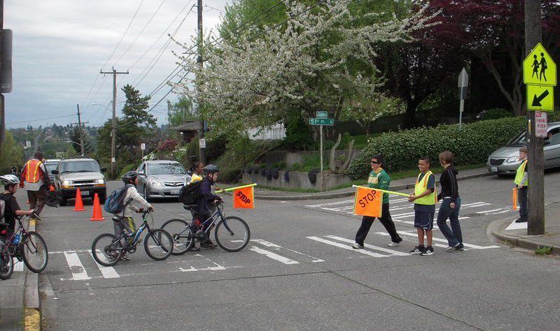
- Seattle's Safe Routes to School program, built 29 road safety improvements near schools in 2020 and 2021, including neighborhood greenway connections, new sidewalks, new crossings, and speed humps that will help kids walk or bike to school safely. The new School Streets pilot program also added space for kids in front of schools.
- Seattle also distributed 21,500 free ORCA cards (transit passes) to 18,000 students this year, in addition to 3,500 essential workers and Seattle Housing Authority residents.
 These exciting projects will help keep people safe and comfortable when biking around Seattle, and we're thrilled. We're also looking forward to more transformational projects in 2022, including the Georgetown to South Park Trail, a new protected bike lane on Dr. Martin Luther King Jr Way from Rainier Ave S to Judkins, the Pike Pine Renaissance, and more!
Thank you for all that you do to make improvements like this possible! If you can, please pitch in to help make more important projects possible next year and beyond.
These exciting projects will help keep people safe and comfortable when biking around Seattle, and we're thrilled. We're also looking forward to more transformational projects in 2022, including the Georgetown to South Park Trail, a new protected bike lane on Dr. Martin Luther King Jr Way from Rainier Ave S to Judkins, the Pike Pine Renaissance, and more!
Thank you for all that you do to make improvements like this possible! If you can, please pitch in to help make more important projects possible next year and beyond.
 Safe travels,
 Clara Cantor
Community Organizer
Clara Cantor
Community Organizer