2025 Construction Highlights: Safer Streets and Better Connections in Seattle
- JoshHolland
- Dec. 19, 2025
2025 was a transformational year for street safety, biking, and walking in Seattle. Across the city, new projects opened that make our streets safer, more accessible, and more connected for everyone—whether you bike, walk, roll, or take transit. From South Seattle to the Waterfront, here’s a look at some of the construction highlights in Seattle that made our streets safer.
It was a banner year for bike route construction as the city caught up on promises to voters after 10 years of delays. Hard-won advocacy by Seattle Neighborhood Greenways and neighborhood groups in our coalition was essential to pushing the city to follow through on those promises, which became a reality.
A Connected Bike Path from West Seattle to Downtown!
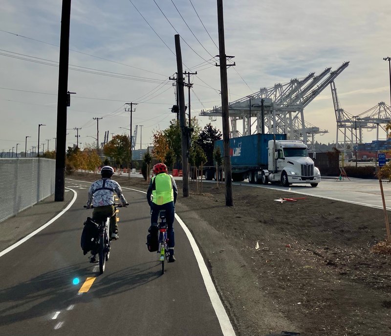
The northern segment of the East Marginal Way Improvement Project is now complete. This route connects the West Seattle Bridge Trail to the downtown bike network with a safe bike path for people of all ages and abilities for the very first time!
Special shout-out to West Seattle Bike Connections for championing this project for many years, from idea to completion.
The project took long-term collaboration among bike advocates, freight interests, and the city, and resulted in:
- A two-way protected bike lane separated from freight traffic with wide planting strips, curbs, and concrete barriers.
- Rebuilt west-side sidewalks with ADA-compliant ramps and crossings.
- Railroad crossing upgrades at S Hanford St, S Horton St, and S Hinds St, traffic signal improvements, including freight- and bike-priority signals, hundreds of new trees, plus utility upgrades for water and stormwater.
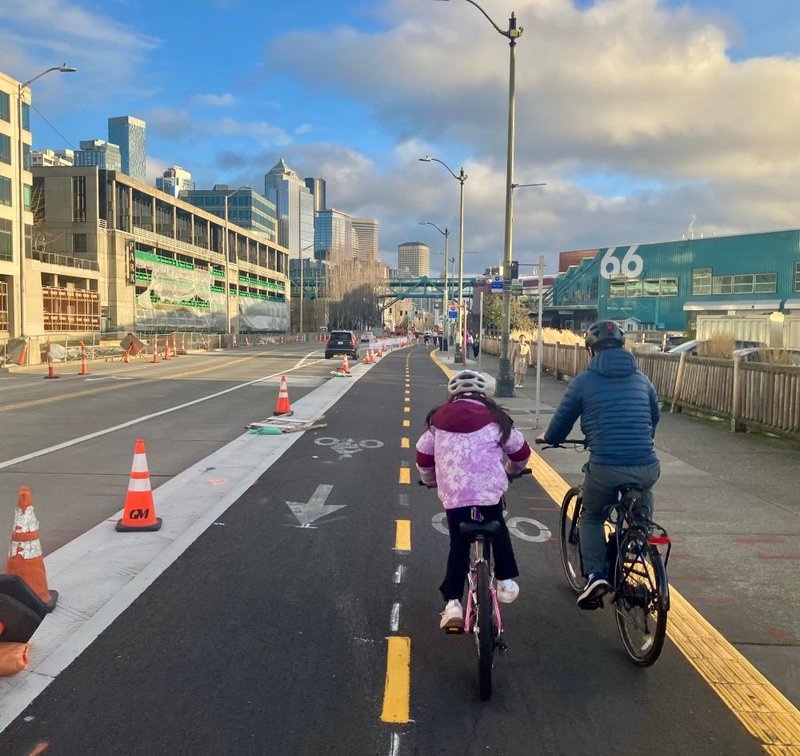
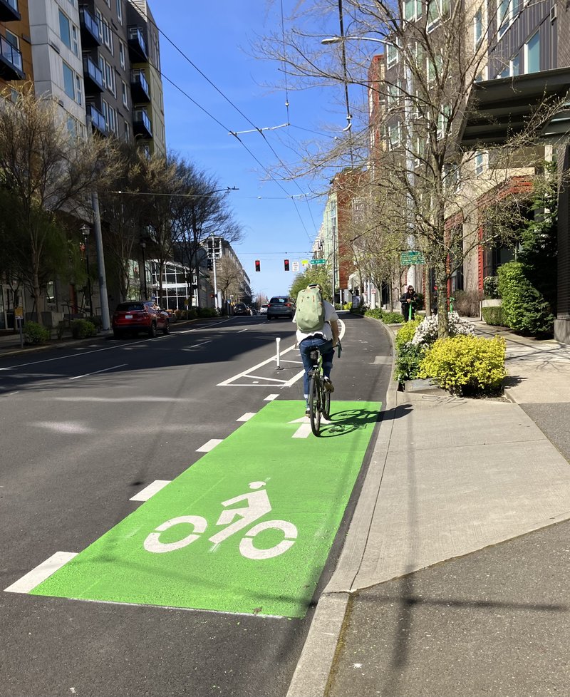
Walking and Riding the Downtown Waterfront
For the first time in history, Seattle now has a continuous 3.26-mile waterfront trail, from Pioneer Square’s Yesler Way to the Elliott Bay Trail. With clean, safe, biking connections all the way from the Ship Canal Trail, along the waterfront, south through SODO, and out to Alki Point, this route could be the most used bike lane in Seattle. Key highlights include:
- The Alaskan Way Safety Project features a 0.6-mile two-way protected bike lane, safer intersections with pedestrian and bike signals, and ADA-accessible sidewalks.
- Connections to the Park Promenade and the Waterfront Trail make it easier and more enjoyable for everyone to bike and walk along the downtown waterfront.
This route required tremendous advocacy from neighbors and Downtown Greenways, negotiation with the Port of Seattle, and navigating busy cruise ship terminals. These improvements are a huge step forward for Seattle’s vision of a low-stress, connected city for walking, biking, and rolling.
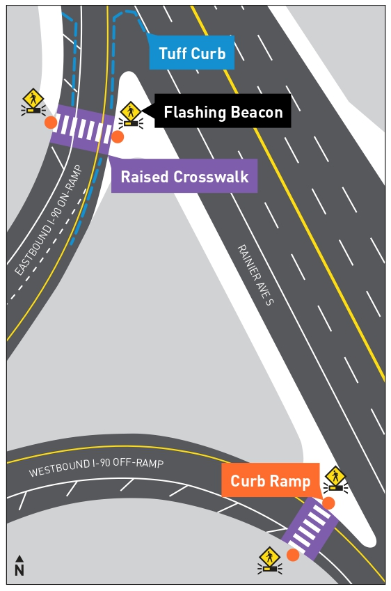
Safer Pedestrian Access Across Highway Ramps on Rainier Ave S
After many years of advocacy fromRainier Valley Greenways and Disability Rights WA, WSDOT installed new raised crosswalks at all four I-90 on- and off-ramps where they connect to Rainier Ave S!
This area is notoriously unsafe, with high speeds and low visibility. The new raised crosswalks will increase safety for this growing neighborhood, especially as the Judkins Park light rail station opens in 2026.
Rainier Ave S, still one of Seattle’s most dangerous streets, also received new center medians, neighborhood greenway crossing improvements, and extended bus lanes, making the street safer and improving reliability for thousands of transit riders each day. At the same time, advocates continue pushing for a complete redesign to address the street’s long-standing safety challenges.
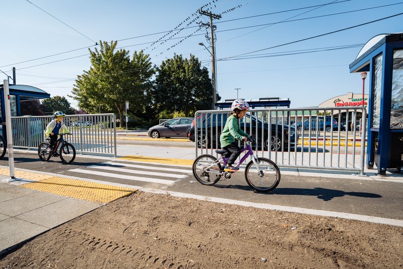
Safety in North Beacon Hill
From the Jose Rizal Bridge through the Beacon Hill business district to Jefferson Park, nearly 1.7 miles of new protected bike lanes, traffic calming, and pedestrian improvements were completed in September. This didn’t happen by accident — it happened because of years of sustained advocacy led by Beacon Hill Safe Streets (BHSS), with support from Seattle Neighborhood Greenways and a broad coalition of community members.
For more than a decade, BHSS organized neighbors, showed up to public meetings, led rides and walks, and refused to accept a South Seattle transportation system that left people biking, walking, and riding transit behind. When planned bike projects were cut in 2019, Beacon Hill advocates pushed back hard — demanding accountability, restoring funding, and making it clear that the South End deserved safe, all-ages-and-abilities connections.
That persistence paid off. The Beacon Ave S and 15th Ave S safety project now delivers long-promised improvements along a critical corridor, making everyday trips safer for people walking, biking, and riding Route 36. And the work isn’t done. Advocates continue to push for the project to extend further south along the entire spine of Beacon Hill — building toward a continuous, safe route and a more connected future for Southeast Seattle.
Duwamish Valley Bike Connections
Over 3.5 miles of new bike routes now connect South Park, Georgetown, SODO, and downtown. Individually, each project is transformative; together, they create a safer, low-stress network that drastically improves mobility in historically underserved neighborhoods. These new bike routes will not only serve neighborhood residents and workers, but also represent the city's response to historic and ongoing inequitable land-use practices that have divided communities across the Duwamish Valley since the straightening of the Duwamish River. It is also the result of more than 25 years of community advocacy for safe connections between the neighborhoods. This achievement belongs to the community advocates who refused to give up.

Expanded NE Seattle Bike Network
New protected bike lanes, sidewalk repairs, and crossing improvements along 11th and 12th Ave NE opened this spring, spanning 1.25 miles connecting Roosevelt, Ravenna, and the U District between NE 43rd and NE 67th St. This project expands the network and makes travel more comfortable and safer to the light rail, business districts, and more.
Sidewalks and Safe Routes to School
Thanks to tireless advocacy for the 2024 Transportation Levy, Seattle saw a 40% increase in new sidewalk construction this year, improving access to schools, transit, services, and business hubs. SDOT also expanded the School Streets program to 19 schools, with permanent street closures at Maple Elementary and Olympic Hills Elementary. Additional safety upgrades, including all-way stops and improved crossings citywide, help make it safer for kids to get to school.
Other Notable Projects
- 15th Ave W/NW & Ballard Bridge: Safety and paving improvements.
- Bell St: Narrowed vehicle lanes to expand space for walking, biking, and public space.
What This Means
Each of these projects is more than a construction milestone—they are steps toward a safer, more equitable, and people-first Seattle. From protected bike lanes to safer intersections and connected trails, 2025 showed what happens when advocacy, planning, and community priorities align.